WorldPulse Earth Weather Clouds & Temperature app for iPhone and iPad
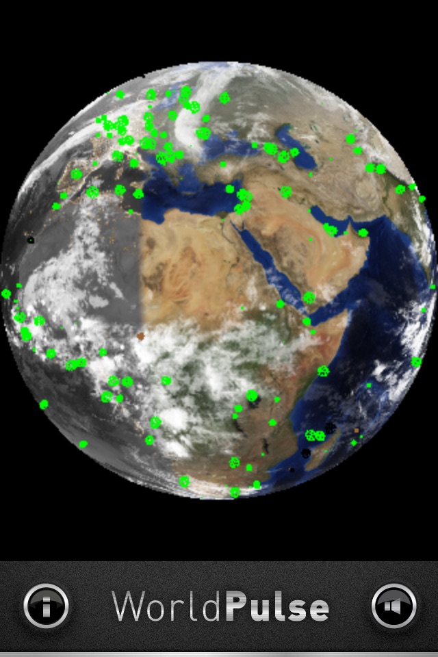
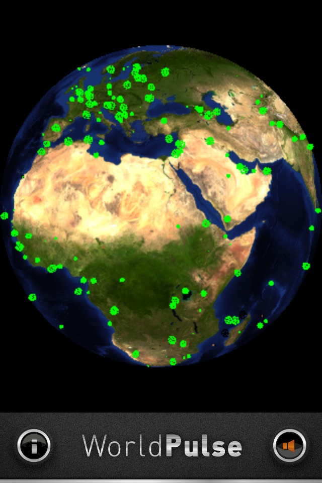
Reach out and tap every country world wide to test internet connectivity. Rotate the globe, zoom in, out, tap to see maps, see the real time cloud cover on our living planet, watch the day/night time line move.
Now with FREE FREE FREE in-app ad-hoc weather purchase to remove iAds
Reach out and tap and see how hot or cold your parents are, how chilly is the south pole, or warm is your last vacation spot.
From your iOS device you can reach out and touch every country in the world with a connection request, then see how long it takes for them to respond. Youll never have to leave home, but you can touch them ten thousand kilometres away.
When you send a packet to Gibraltar it arrives in Gibraltar, not at a server in the United Kingdom, or at a cloud computing centre in the USA.
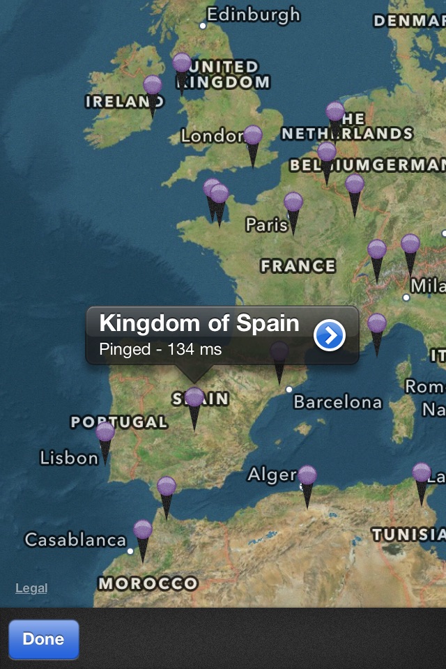
See how well your internet access provider is dealing with access to all the Worlds countries, plus as a bonus youve easy access to maps for any point on the globe, plus knowing what the weather is, and if its daylight or dark.
Yes we show REAL cloud data every three hours, and YES we move the day/night terminator line every 15 minutes. We are LIVE! Tap and move, pinch expand.
Tactical feedback, people tell us tap and move isnt instant. Look you are moving 6,000,000,000,000,000,000,000,000 Kilograms of Earth! Its wet its heavy its slippery what do you expect. we try. Just FEEL the globe as it moves...
Or just check the weather which shows current conditions for any point on the globe where there is a nearby weather station for conditions in the last hour, and very accurate forecasts for the next two days.
Pros and cons of WorldPulse Earth Weather Clouds & Temperature app for iPhone and iPad
WorldPulse Earth Weather Clouds & Temperature app good for
Ejete are the servers topology? And what mean dot and Tdl or something like that ?
I did not realize there was so many countries in the world, and that they are mostly are wired to the world. Even places I didnt expected! The connection to google maps is great, at dinner some wanted to see the sultans palace in east timor as he was there earlier in the summer. 389ms ping time.
Its not giving you the meaning of life but it is really cool app. Nice functions but Im sure there is a room to improve.... Thank you!!
Like having millions of pen pals without having to write a word
Some bad moments
This is a shame. Dont waste your time. TERRIBLE. It does .... NOTHING. These designers need to find a new life purpose. I am being truthful. Wow waste of my time. You should be ashamed.
Pinch to zoom is too sensitive. Please lessen the sensitivity and add more images and make them higher resolution.
Amazing didnt realize there was so many countries in the world and that they are mostly all wired to the internet. The fact I can double-tap to view google maps was great. At dinner tonight as a friend wanted to see the Palace in East Timor as he actual was THERE this summer, we zoomed down to his favourite beach. 389 ms Im told to echo to East Timor somewhere.
Emailed the developer again, they tell me they added day & night time views to this now, but I found the cloud data a bit har har *cloudy*. But in 1.2 you can turn that off. App just gets better and better over time.
At least now I can see if my telephone company actually is providing access to any country in the world and how spotty their service is. You do wonder if our government or telco is block access to certain countries, this proves they are not., at least for me.
The app is poorly conceived and badly put together. A sparkling globe revolves, makes pinging noises, and one can drill down to a map which is poor quality (great rectangular sheets of Lake Malawi extend onto the land) which then allows you to look at a pin which makes a claim about ping time. Thats it. If you press i, then a page of gibberish covers the screen which cant be got rid of. Its idiotic and Im a fool for having bought it.
Probably one of the more unique ways of using a "google earth format". I have to say the live cloud-cover and light terminator was pretty cool. I found myself wasting some time on the bus watching storm clouds forming off the west coast, and was completely unsurprised to get hit by heavy winds that evening. The ability to know just how well my isp is connecting me to each country is pretty cool too. (I was disappointed that the ping time to where my brother moved to is so high).
Given the high turn around on updates, and the number of interesting features being added each time, Ill go with a 5 for an interesting app + effort. The free part is a bonus. It would be nice to see better resolution and a more definite location mapping for different cities etc.
Edit: Oh, theres a pro version, nm.
Should have a option to customize colors according to different latency time intervals.